

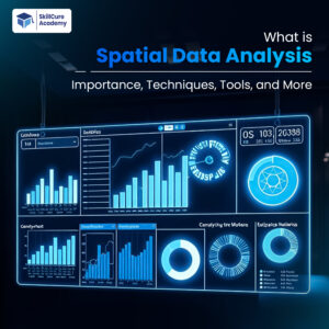
Spatial Data Analysis is the process of examining geographic or location-based data to identify patterns, trends, and relationships. It helps organizations understand how location impacts decisions, operations, and outcomes. From navigation apps and smart cities to agriculture and healthcare, spatial analysis is becoming an essential part of modern technology.
Spatial data usually includes coordinates such as latitude and longitude, maps, satellite images, or geographic boundaries. By combining statistics, mapping, and data science, spatial analysis transforms raw geographic data into meaningful insights.
Importance of Spatial Data Analysis?
Spatial data analysis is important because it helps businesses and governments make accurate location-based decisions.
| Importance | Description |
|---|---|
| Better Decision-Making | Helps organizations plan using geographic insights |
| Resource Optimization | Improves route planning and resource allocation |
| Risk Management | Identifies disaster-prone or high-risk areas |
| Business Growth | Helps companies target customers effectively |
| Environmental Monitoring | Tracks pollution, climate, and natural resources |
Industries use spatial analysis to improve efficiency, reduce costs, and increase productivity.
Types of Spatial Data?
Spatial data is mainly divided into two categories:
| Type | Description | Example |
|---|---|---|
| Vector Data | Uses points, lines, and polygons | Roads, buildings, cities |
| Raster Data | Uses grids or pixels | Satellite images, weather maps |
Vector data is commonly used for maps and boundaries, while raster data is useful for environmental and satellite analysis.
Techniques Used in Spatial Data Analysis?
Several techniques are used to analyze geographic data effectively.
1. Buffer Analysis.
Creates zones around geographic areas.
Example:
- Studying traffic around schools.
- Disaster management near rivers.
2. Overlay Analysis.
Combines multiple map layers to identify relationships.
Example:
- Population density with hospital locations.
3. Hotspot Analysis.
Identifies areas with high activity or concentration.
Example:
- Crime hotspot identification.
- Disease outbreak tracking.
4. Network Analysis.
Used for route optimization and transportation planning.
Example:
- Delivery route optimization.
- Traffic management systems.
5. Spatial Interpolation.
Predicts unknown geographic values using nearby data.
Example:
- Rainfall prediction.
- Temperature forecasting.
Popular Tools for Spatial Data Analysis?
Many advanced tools are used for geographic analysis and visualization.
| Tool | Purpose |
|---|---|
| ArcGIS | GIS mapping and spatial analysis |
| QGIS | Open-source geographic analysis tool |
| Google Earth Engine | Satellite imagery analysis |
| Python | Spatial data programming and automation |
| Tableau | Geographic dashboards and reporting |
| Power BI | Interactive map visualization |
These tools help analysts process, visualize, and interpret large geographic datasets.
Role of Python in Spatial Data Analysis?
Python is one of the most widely used programming languages for spatial analytics because it supports powerful libraries for geographic processing.
| Python Library | Function |
|---|---|
| GeoPandas | Geographic data handling |
| Shapely | Geometric operations |
| Folium | Interactive map creation |
| Rasterio | Raster data processing |
| PySAL | Spatial statistical analysis |
Python helps automate spatial workflows, create maps, and perform advanced geographic analysis.
Applications of Spatial Data Analysis?
Spatial data analysis is used in many industries.
Urban Planning:
Governments use spatial analysis for:
- Smart city development.
- Road planning.
- Traffic management.
- Population analysis.
Agriculture:
Farmers use geographic data for:
- Precision farming.
- Crop monitoring.
- Soil analysis.
- Irrigation planning.
Healthcare:
Healthcare organizations use spatial analytics for:
- Disease tracking.
- Ambulance route optimization.
- Healthcare accessibility mapping.
Retail and Marketing:
Businesses use spatial data for:
- Store location analysis.
- Customer targeting.
- Market expansion planning.
Logistics and Transportation:
Spatial analysis improves:
- Route optimization.
- Fleet tracking.
- Supply chain efficiency.
Benefits of Spatial Data Analysis?
| Benefit | Description |
|---|---|
| Improved Accuracy | Provides precise geographic insights |
| Faster Decisions | Enables quick planning and analysis |
| Cost Reduction | Optimizes operations and resources |
| Better Visualization | Makes complex data easier to understand |
| Predictive Insights | Helps forecast future trends |
Organizations using spatial analytics gain a competitive advantage through smarter planning and improved efficiency.
Challenges in Spatial Data Analysis?
Despite its benefits, spatial analysis also faces some challenges.
| Challenge | Explanation |
|---|---|
| Large Data Volumes | Geographic datasets can be massive |
| Data Accuracy Issues | Incorrect coordinates affect results |
| Complex Processing | Requires technical expertise |
| Privacy Concerns | Location data can create security risks |
| Integration Problems | Difficulties combining multiple datasets |
Proper data management and advanced tools help overcome these challenges.
Future of Spatial Data Analysis?
The future of spatial analytics is growing rapidly with advancements in AI, IoT, and cloud computing.
Emerging Trends:
| Trend | Impact |
|---|---|
| AI-Powered GIS | Smarter geographic predictions |
| Real-Time Analytics | Faster live location insights |
| Drone Mapping | Better surveying and monitoring |
| Smart Cities | Improved urban management |
| 3D Geographic Modeling | Advanced visualization systems |
Businesses and governments are increasingly investing in location intelligence to improve services and decision-making.
Career Opportunities in Spatial Data Analysis?
Spatial analytics professionals are in high demand across industries.
| Job Role | Responsibility |
|---|---|
| GIS Analyst | Geographic mapping and analysis |
| Spatial Data Scientist | Advanced location intelligence analysis |
| Remote Sensing Analyst | Satellite image processing |
| Urban Planner | Infrastructure and city planning |
| Geospatial Engineer | GIS systems development |
Professionals with GIS, Python, and data visualization skills can build strong careers in this field.
Final Thoughts.
Spatial Data Analysis is transforming how organizations understand and use geographic information. It helps improve business strategies, urban planning, healthcare systems, agriculture, and environmental monitoring through location-based insights.
With the increasing use of AI, GIS, and real-time analytics, spatial data analysis is becoming one of the most valuable fields in modern data science. Learning spatial analysis tools and techniques can open excellent career opportunities while helping organizations make smarter and more efficient decisions.
Frequently Asked Questions (FAQs).
1. What is spatial data analysis?
Spatial data analysis is the process of studying location-based data to identify geographic patterns and relationships.
2. Which tools are used in spatial data analysis?
Popular tools include ArcGIS, QGIS, Python, Tableau, and Google Earth Engine.
3. Why is spatial data analysis important?
It helps organizations make better decisions using geographic insights and location intelligence.
4. Is Python useful for spatial analysis?
Yes, Python is widely used because of libraries like GeoPandas, Rasterio, and Folium.
5. What industries use spatial data analysis?
Industries such as healthcare, agriculture, logistics, urban planning, and retail use spatial analytics extensively.